Ali Bedni Bugyal Trek
Speak to our expert Trek Advisors to help you choose the right trek.
Have Questions About This Trek?
Send us your enquiry and we'll get back to you soon.
About This Trek
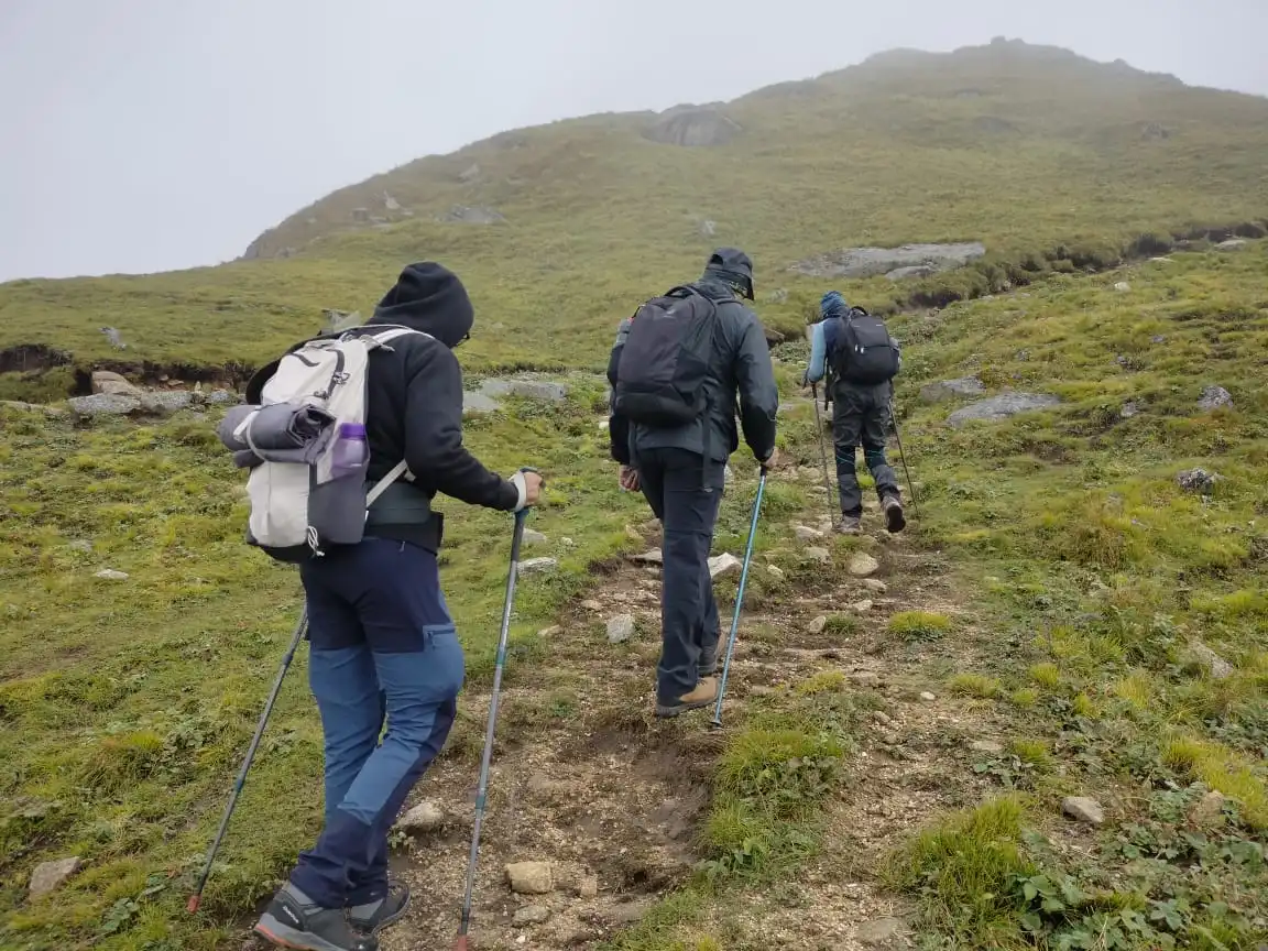
The subtle delicacy of this Himalayan sojourn enamors one with the grandest grandeur of twin grasslands. Ali Bedni Bugyal trek is the beautiful amalgamation of 2 scenic meadows -Ali Bugyal and Bedni Bugyal. These mammoth meadows stun you with an infinite expanse of green carpet flanked by the Himalayan giants of Mount Trishul and Nanda Ghunti. The colossal Himalayan ranges stretching from Chaukhamba to Neelkanth to Mandani, Mrigthuni, and Kedarnath are the prime attractions of the trek. The imposing peaks resplendent with the golden rays of the sun at dawn and dusk are a sight to behold. Meandering trails through thick Conifers and deep dark woods are soaked with natural splendor. The winding trails are lined by the fauna of oak, rhododendrons, walnut, pear, and Himalayan roses. As one journey along, the warbling wind and chirping of mountain birds are your constant companions. What strikes you in the face is the sudden epiphany of the lush blanket as soon as the dense tree line disappears. You spend 2 days in this lavish bounty of verdurous greenery.
All this plus one gets a chance to explore the mountain villages of Didna & Wan and learn about the customs & lifestyles of the local populace. The temples of Nanda Devi and Latu Devta (local deity) offer a devout rendition of the trek. Bedni Kund at the Bedni top is a site of religious reverence for locals. The once famous Roopkund trek was a part of this trekking trail. The twin meadows were the major highlights on the Roopkund Trek. Due to the ban by the honorable High Court of Uttarakhand, Roopkund Trek cannot be undertaken until further notice. The Ali Bedni trekking trails are much quieter and calmer as a result of this ban.
A glance at some focal points of Ali Bedni Bugyal Trek
- Region- Uttarakhand Himalayas
- District-Chamoli
- Trek Altitude- 12,550 feet (highest point-Bedni Top)
- Trek Difficulty Level- Easy to Moderate
- Trek Duration- 6 Days
- Distance- 31 km
- Start Point- Rishikesh
- End Point- Rishikesh
- Base Camp- Lohajung (250km from Rishikesh)
- Season- All-season trek except monsoon
- Nearest Railway Station- Dehradun or Haridwar railway station (backward journey)
- Nearest Airport- Dehradun Airport
- Last ATM- At Deval (mostly has little cash). It is best to withdraw cash from Rishikesh/Haridwar/Dehradun
- Mobile Connectivity- Lohajung has good connectivity with all major networks. Under ideal weather conditions, networks of Airtel, Idea, and Vodafone have good connectivity at Didna.
About Ali Bedni Bugyal
Perched at an elevation of 12,550 feet, Ali Bedni Bugyal is known to be Asia’s largest grassland sitting in the Himalayan lap. It is strategically located on the border of Garhwal and Kumaon region, in the state of Uttarakhand.
Bugyal means alpine meadows in the local dialect. The high-altitude bugyals always grow above 10,500 feet and below 13,000 feet.
If Ali Bugyal is flanked by a dense coniferous forest on its slopes, the pretty mountain lake of Bedni Kund compliments the beauty of Bedni Bugyal. The clear reflection of the majestic Mt. Trishul massif on the crystal-clear waters of Bedni Kund is simply surreal. The magnificent view of the revered Mount Trishul at the sprawling Ali Bugyal is imposing. At Bedni, Mt. Trishul and Nanda Ghunti stand tall as if safeguarding the rolling meadow under their protective embrace.
History of Ali Bedni Bugyal
Ali Bugyal and Bedni Bugyal are the landmarks of the famous Roopkund trek. Sadly, the Roopkund trek has been banned due to the damage caused to biodiversity because of excessive trekking.
These double meadows provided the ideal ground for acclimatization to the high-altitude Roopkund Trek. A 23 km trek from Bedni Bugyal led to the once-famous Roopkund trek.
The basecamp of Lohajung is rooted deep in a legend. History has it that Goddess Parvati killed demon Loha at Lohajung. He blocked her way when she was going to meet her paramour the revered Lord Shiva in the mountains.
How to reach Ali Bedni Bugyal?
- By Train-
- By Road-
- By Flight-
Dehradun/Haridwar is well-connected to major cities of India like Delhi, Lucknow, etc. by train. From Rishikesh to Lohajung, it takes around 10-11 hours by road.
Rishikesh is well-connected with most of the major cities of India like Delhi, Lucknow, etc. by road. From Rishikesh to Lohajung, it takes around 10-11 hours by road.
Reach Dehradun from Delhi by flight. There are flights available every day from Delhi and the flying time is 1 hour. Rishikesh is at a distance of 21 km from Dehradun Airport, it takes around a 45-minute drive to reach Rishikesh from the airport.
Reaching the bugyals is easy. The trek commences from Lohajung which is a 10-11-hour drive of approximately 250 km from Rishikesh. It takes 5 days to reach the summit and come back to Lohajung village. There is a proper motorable road to Lohajung; beyond that, you walk your way through the scenic terrain of Uttarakhand Himalayas.
Ali Bedni Bugyal Trek Best Time
This is an all-season trek which can be undertaken throughout the year. Be it spring, summer, fall, or winter, each season bestows upon you a distinct vista of changing colors and contrasting landscapes.
However, it is best done from April to June and, from September to October.
- March to June (Spring-Summer)-
- July and August (for greener meadows)-
- September to November (fall colors)-
- December to February (snow)-
The spring months of March and April treat you to snow, especially the Bedni top. One may witness snowfall till as late as early May. In April, there is residual snow with little chance of fresh snowfall. The skies are clear in March & April. You may spot blooming rhododendrons on trekking trails. The summer months of May and June are good months to set your foot on this trek. Meadows start turning green and clear weather permits excellent mountain views.
The rains infuse the meadows with brand new life and vigor. The colorful assortment of flowers in infinite hues leaves you spellbound. The region insufflates the fragrance of fresh flowers and virginal grass. A trifle tricky but monsoon months are perfect for those who love rains and its earthy aroma.
The air is fresh & crisp, and the sky radiates in a perfect tint of blue. You may witness sporadic rains in September. Bugyals are still peppered with flowers and radiate with green grass in September.
In October, the fall colors start to appear. The grass changes from green to yellow to golden brown. You luxuriate in the amazing shades of reds, browns, cognac, and orange!
In November, the temperatures begin to fall and there’s a nip in the air. The skies are clear and the weather is pleasant in the daytime. Fall months are ideal for avid photographers who love to capture the panorama of fall colors and clear massifs with their lens.
If you are a winter freak and snow gives you the adrenaline rush, then winter months are your true calling! The meadows are blanketed in a sheath of white and snow-drifted trees line the snow-laden trekking trails.
Ali Bedni Bugyal Weather
The weather is unpredictable and keeps changing frequently in Bugyals. While mornings are usually clear, afternoons are often blanketed under thick mist from the mountains. Evenings are pleasant but nights tend to get colder.
Ali Bedni Bugyal Temperature
- Spring-Summer months of March-June:
- Monsoon months of July-August:
- Fall/Autumn months of September-November:
- Winter months of December-February:
Daytimes are warm and pleasant in the summer months of May and June. The temperature varies from plus 2 degrees to plus 10 degrees.
The temperature varies from plus 3 to plus 16 degrees between night and day.
Daytime temperature is warm and pleasant in the fall months. Nights start getting colder, especially from mid-October. The temperature varies from plus 2 to plus 10 degrees in the daytime to plus 5 to 0 degrees during nights between September to November.
Daytime temperatures remain cold with a temperature range of +2 to -2 degrees. Mornings and nights are frigid with temperatures ranging between -5 to -!0 degrees.
Difficulty Level of Ali Bedni Bugyal Trek
This trek is of moderate difficulty level. The altitude gain of approximately 4,000 feet over two days is not formidable. The trekking route is a mix of gradual ascends and descends interspersed with some steep climbs.
Is Ali Bedni Bugyal Trek Safe?
One of the easiest and safest treks of Uttarakhand, Ali Bedni Bugyal trek traverses through two stretches of civilization-Didna and Wan Village. Wan village is quite a big hamlet in comparison with the quaint mountain villages that one encounters while undertaking other treks in Uttarakhand.
There are some ground rules of any mountain trek that one should follow and that goes for this trek too-
- Avoid trekking in monsoons. Rains make the terrain slippery. The area is prone to landslides & cloud bursts leading to roadblocks and risky trekking conditions.
- It is highly recommended to take an experienced tour guide/local person to help you navigate safely. This will also avoid you from going off-track.
- Always trek in a group of 4-5 people and not less. Mountains are infamous for unpredictable weather conditions and often interspersed with some stretches that require careful maneuvers. Inform your loved ones about your travel plans and trek route in advance
Fitness Required for Ali Bedni Bugyal Trek
Despite being a trek of the easy gradient, Ali Bedni Bugyal trek calls for a minimum fitness level and cardiovascular stamina. One can start preparing for the trek by running, jogging, cycling and swimming.
Best Time to Visit
The best time for this trek is during December to March when the weather is pleasant and the views are clear.
Trek Details
Start Point
Lohajung
End Point
Lohajung
Pickup Location
Rishikesh/Haridwar
Drop Location
Rishikesh/Haridwar
Health & Safety
- For any Himalayan Trek, Ideal BMI for a trekker should be 18.5 to 24.9
- To keep a check of this please calculate BMI here
- Below given Safety checks should be done to get prepared for any Himalayan Trek.
- Balance : As well said a balanced mind and body gives out best in every condition and that too works in Himalayan treks as well.
- Legs Strength : Body and Legs Strength is required to carry body weight as well as the backpack while trekking in uneven multi terrains. Generally, a good strength on legs works out good in any Trek. One can gain legs strength by doing simple Squats.
- Muscle Flexibility : While trekking in Trans Himalayan region with a flexible body one can easily achieve full range of movement and this can be really helpful for trekkers as well as trek leads. A good flexible will be an advantage while walking on trails, climbing and river crossing etc. Flexibility can be achieved by simple stretching, yoga etc.
- Cardiovascular Endurance : Cardiovascular endurance is defined as the ability of lungs and heart to transmit oxygen to the body muscles. All Himalayan treks are basically ascending descending the slopes and for this trekkers should be having a good cardiovascular endurance. Anyone planning for a Himalayan trek can attain this capacity by doing any cardio exercise like running, swimming, cycling etc.
Speak to our expert Trek Advisors to help you choose the right trek.
Have Questions About This Trek?
Send us your enquiry and we'll get back to you soon.
Have Questions?
Speak to our expert Trek Advisors to help you choose the right trek.