Gomukh Tapovan
Speak to our expert Trek Advisors to help you choose the right trek.
Have Questions About This Trek?
Send us your enquiry and we'll get back to you soon.
About This Trek
Ganga, often worshipped as Goddess in India, a sign of purity and spirituality serves as a lifeline to millions of Indians who live along its course and depend on it for their daily needs. Gomukh, a place in Gangotri glacier located at an elevation of 3889m is the birth source to river ganga. Witnessing Ganga's birth source has always been a golden opportunity for people and the shine in their eyes while having the dip in the Gomukh is never less than a million dollars. Gomukh means mouth of a cow. Why is this place referred to mouth of a cow, I asked to a pilgrim who was standing next to me looking flawlessly at the people who were in water, The sages called it 'Gomukh', because it probably appeared like a cow's mouth in the past., he added.
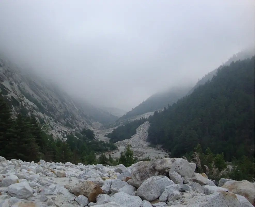
The element of trek from Bhojwassa to Gomukh is amazing, the essence of panoramic view of Bhagirathi group of peaks is pure enough to energize one to follow his commitment to Gomukh glacier. I felt it's not just the religious spirit that energizes one after a dip in such chilling water, but also the natural scenic beauty that is responsible for an appraisal to such a wonderful experience!
Gaumukh-Tapovan is a moderate-difficult trek. While the Gangotri-Gaumukh trail is fairly moderate and is often used by pilgrims, the Gaumukh-Tapovan trail demands experience. One who have done a couple of high-altitude treks like Roopkund can opt for it but a beginner must never prefer it.
About Gaumukh Tapovan Trek
Gaumukh Tapovan trek combines mythical significance, divinity, and ethereal beauty. This trek is one of the most gratifying and rewarding treks in India. Gaumukh trekking is an irresistible call for those nature lovers who genuinely want to engage themselves with mountaineering, hiking, and traversing the awe-inspiring glaciers. The altitude of Gaumukh stands tall at 3889m. It is the terminus of the Gangotri glacier from where the Bhagirathi River originates. This river is known as Bhagirathi at the source and takes the name Ganga from Devprayag onwards. Gangotri to Gaumukh trek distance marks up to 18 km, presenting a wild topography throughout this stunning trek.
The trekkers flock to Gaumukh to embrace the holy and pure air. It is in Gaumukh where you can find the pristine river Ganges gushing out from the glaciers. The Gaumukh glacier is the most fascinating point of Gaumukh trekking. The ground of this gigantic glacier pulsates with the continuous fall of the big chunks of the ice from the mouth of the glacier. The deep crevasses on the glacier make it all the more mysterious. One should be very careful and attentive while navigating through these crevasses.
Gaumukh acquired its name from the sages, meaning cow’s mouth as the opening of Gaumukh appears like the mouth of a cow. This place has an immense religious significance to the Hindus. Gaumukh is thronged by the devotees every year who come here for repose and take blessings from Maa Ganga. Gaumukh is considered one of the very important aspects of Hindu Mythology.
It centers on the river Ganga which has undergone rebirth after sage Bhagirath’s insistence. He wanted his ancestors to get rid of their committed acts of guilt, making them walk the path to heaven. Gaumukh, often termed as Ganga’s birth source is considered as a golden opportunity for all the pilgrims and devotees and other trekkers who want to wash away their sins and acts of guilt by having a dip in Gaumukh, and attain mental peace.
The trek trail from Bhojbasa to Gaumukh is delightful passing through the snow-capped Bhagirathi Sisters and the enchanting alpine meadows. This surreal location also keeps you entertained with the mesmerising views of the elegant Mt. Shivling.
Tapovan Uttarakhand is high-altitude grassland in India, emerging as one of the most popular trekking destinations. Tapovan is a Sanskrit word that means penance and religious austerity. In Tapovan you can indulge in meditation or any spiritual practice. It will help you discover your own true self. This enchanting grassland, enveloped with lush green forests is quite a difficult uphill trek and is located close to the famous Gangotri Shrine. Nestled in the lofty Shivling Peak, Tapovan Uttarakhand is home to a number of sages. The trek trail traverses through the beguiling meadows, sparkling streams, and the arduous majestic mammoths.
The Gaumukh Tapovan trek distance is 46 km long, perched at an elevation of 14,600 ft above sea level. This trek is a visual thrill with rising mountain peaks such as the Bhagirathi Sisters and Mt. Shivling. Located in the Uttarkashi district of Uttarakhand, this trekking trail snakes through a beautiful orchard of coniferous pine trees at Chirbasa, birch trees at Bhojbasa, and the well preserved Gaumukh National Park. Exploring and delving deep into the mystical beauty of the Gaumukh glacier, just 4 km ahead of Bhojbasa is an unforgettable visit.
You have to have a Gaumukh trek permit before venturing out on this stellar journey. The Gaumukh trek permit can be sanctioned by the District Forest Officer in Uttarkashi. It can also be obtained from the Forest Officer in Gangotri. A daily quota of 150 permits per day is maintained and strictly followed. The Gaumukh trek permit is issued on a first-come-first-served basis.
Camping at the base of Mt. Shivling, termed as “Matterhorn of Garhwal” can be a superb idea. Here you can gaze at the star-lit night sky, against the backdrop of the lofty mountains and the virgin landscapes. Sunrise from the picturesque campsites offers a hypnotic view of the sunlight illuminating the peaks and landscapes with its amazing hues.
Quick Facts About Gaumukh Tapovan Trek
- Region: Uttarakhand
- Trek Altitude: 14,600 ft
- Trek Difficulty Level: Moderate To Difficulty
- Gaumukh Tapovan Trek Duration: 8 Days
- Gaumukh Tapovan Trek Distance: 46 km
- Start Point: Gangotri
- End Point: Gangotri
- Base Camp: Gangotri
- Best Seasons: May to June, September, and October
- Temperature: 13 degrees Celsius to 20 degrees Celsius (Daytime), 5 degrees Celsius to 7 degrees Celsius (Night)
- Nearest Railway Station: Dehradun
- Nearest Airport: Jolly Grant
- Avalilibility of ATM: Urrarkashi
How to Reach the Basecamp?
- By Road:
- By Rail:
- By Air:
From Delhi, you can take a bus to Dehradun from Delhi’s ISBT Kashmere Gate. It usually takes around 5 hours 15 minutes to reach, covering a distance of 245 km. The fare ranges from INR 400 to INR 4200 depending upon the comfort and luxury desired.
The distance from Dehradun to Gangotri is 240 km, which will take about another 8 hours to reach. From Dehradun, you have to take a cab to Uttarkashi. It will take about 5 hours to reach, covering a distance of 142.7 km. The cab fare is around INR 2500 approximately. From Uttarkashi, you can board a bus or take a shared taxi to Gangotri. It will take about 3 hours to reach, covering a distance of 99.5 km. The bus fare from Uttarkashi to Gangotri will be INR 75 to INR 100 approximately.
From Haridwar, you can hire a taxi to Uttarkashi. It is quite a long 187.5 km journey, from Haridwar to Uttarkashi, requiring 6 to 7 hours to reach. The taxi fare will be around INR 6000 to INR 7000. You can then a bus to Gangotri from Uttarkashi as mentioned above.
From Rishikesh, you can take a bus to Uttarkashi. It will take you approximately 5-6 hours to cover the distance of 169.3 km approximately. The bus fare will be around INR 250 to INR 300 approximately. From Uttarkashi, you can again take a bus to Gangotri as mentioned above.
From Delhi, you can board the Jan-Shatabdi SPL which departs at 3:20 PM and reaches Dehradun at 9:10 PM. It runs on all days in a week. The fare is INR 490 per head (CC). Then from Dehradun, you need to take a cab to Uttarkashi and then again board a bus or take a shared taxi to Gangotri as mentioned above.
You have to take a flight from Delhi to Jolly Grant Airport. It is just 30 km away from Dehradun approximately. It takes you about 1 hour to reach by flight. The flight fare per head will be INR 2,350 approximately. Take a taxi from the airport which takes about 50 minutes to reach Dehradun usually. The taxi fare hovers around INR 1800 to INR 1900. After reaching Dehradun, you will again have to book a cab to Uttarkashi and then board a bus to Gangotri as mentioned above.
Best Time to Visit Gaumukh Tapovan
The Gaumukh Tapovan best time is during the two seasons in a year. The summer and the autumn seasons are categorized as the Gaumukh Tapovan best time. During the summer season, the Gaumukh Tapovan trek is done from the middle of May to the end of June. As far as the autumn season is concerned, this trek is conducted from September to the end of October. Winters in Tapovan Gaumukh are extremely harsh and frigid. The heavy snowfalls make the route inaccessible to the trekkers and pilgrims, thereby prohibiting them from entering the glacier region.
Gaumukh Tapovan in Summer:
The trekkers who are addicted to trekking in snow can choose this season for their trek. In early summers, the trekking trails contain snow and you can also cross the Bhagirathi River over the snowy bridges. By the middle of the season, the snow melts giving way to the green lush vegetation of the area. As the snow melts, the Bhagirathi River overflows with the speedy current. It is advisable to undertake the trek till the month of June. The month of July brings with it erratic downpours which make trek routes susceptible to perilous rockfalls and landslides.
Gaumukh Tapovan in Monsoon:
Monsoons are quite dangerous in the mountains. It receives heavy rainfall during July and August. The trek route is extremely perilous as it brings with it the risks of avalanches, boulders dropping, and skidding of vehicles. The vegetations and the meadows also remain muddies and rain-drenched. So, it is best to avoid monsoon season and start off the trek once the rain subsides. The Gangotri temple and Gaumukh are a part of the Char Dham Yatra. This Char Dham Yatra is done by many devotees during the months of May to October. Though the monsoons have its perils, the devotees still visit the temple and Gaumukh when the trek is not done. So, even when trekking is not favorable during the monsoon season, some parts of the trek always remain open for pilgrimage purposes and for the devotees.
Gaumukh Tapovan in Autumn:
The autumn season in Gaumukh Tapovan is ideal for treks, with its immaculate weather and clear and brilliant views of the entire valley. With the onset of the autumn season, the vegetation of the valley becomes very vibrant with the thickening shades of yellows and browns. The flow of the Bhagirathi River becomes quite calm and gentle in contrast to the summers. The autumn season does not stay for long, extending to just 4 or 5 weeks. Wrap up your trek by all means within the end of October as the winters make the Gaumukh trek untenable.
Gaumukh Tapovan in Winter:
Winters in Gaumukh Tapovan are quite difficult to endure. It also hampers the scope of income from adventure sports such as skating and skiing during the winter. It comes to a halt as the weather gets worse in December and this pious region experiences heavy and dangerous snowstorms. The trek trails are fraught with dangers in the winter season due to the big chunks of snow accumulating from the constant snowfall taking place. It also leads to the blockages of the roads posing obstacles for the local life. It is strictly advised not to embark on this trek during the harsh winter season.
Weather and Temperature
The weather is quite unpredictable during the summers. There are chances of rainfall and late spring snowfall during this season too. The temperature during the day is close to 20 degrees Celsius but at night it gets quite cold, sometimes even dropping to 5 degrees Celsius. In Tapovan, the temperature during the day is close to 15 degrees Celsius but at night it can fall to 0 degrees Celsius also. An ample amount of woolens and a warm set of clothes should be kept handy always.
During the autumn season, it is a few degrees colder than the summers but the weather is quite stable, unlike the summers. The temperature during the day in Gaumukh is around 15 degrees Celsius which is quite pleasant. At night, the temperature drops to 0 degrees Celsius. In Tapovan, at night, during this season, the temperatures often go below 0 degrees Celsius.
The first snowfall arrives sometime around November, blocking the roads and trekking paths and disrupting all the adventure sports.
How Difficult is Gaumukh Tapovan?
The Gaumukh trek falls under the category of a moderate to difficult trek. Trekking 14,600 ft is quite a daunting one. The trek commences at Gangotri which in itself is perched at an altitude of 11,204 ft, making the trek quite challenging. Due to this height acclimatization becomes a necessity.
The routes of the Gaumukh trek are pretty straightforward and moderate and are mostly visited by the pilgrims. The amateur trekkers can also take part in the Gaumukh Tapovan trek but with proper preparation. You can remain physically fit by indulging in speedy walks and brisk joggings. It will increase your blood circulation and improve your cardio. It will also help you to endure long stretches of walking and strenuous uphill treks.
For trekking in Tapovan, you will need permits and an experienced trek guide. The path to Tapovan is quite steep and dangerous. As it is a high altitude trek, you will need to acclimatize yourself by stopping at different spots due to its height and the weather. You will have to cross the glacier which is quite unsafe and you will need a team and a guide to help you throughout. It is recommended that you spend a day at a beautiful campsite in Tapovan, from where you will get a complete panoramic view of Mt. Shivling and other peaks.
Be patient, prepare yourself physically and mentally and embark on this enthralling trek to the holy, divine pilgrimage site, Gaumukh Tapovan.
Is Gaumukh Tapovan Safe?
This place is mostly visited by devotees and occasionally by trekkers. This trek should not be taken lightly as it is a high-altitude trek. You should be spirited enough to have a go at this trek.
There are small sections of the Gaumukh trek where you need to coarse through the large boulders while going from Gangotri to Chirbasa. You should be very careful and alert while passing through this region. Do it under strict guidance and with a team. There are 4 to 5 sections of Kachha Dhaang on this route. These are especially the places that are prone to landslides and rockfalls. Be supremely attentive and steady while crossing this path.
The weather plays spoilsport, especially during the summer. At such an altitude, rainfall and snowfall can happen anytime but it is absolutely unforeseeable. The paths become slippery and sometimes your trek plans go awry due to the vagaries of the mountain weather. Resume your trek when it is safe, and with proper assistance. Acute Mountain Sickness (AMS) while trekking or mountaineering is quite common and the symptoms are basically dizziness, headaches, and nausea, and muscle troubles. You should certainly consult a doctor if you find these symptoms. Take proper care and be under medication. Also, oxygen is thin at this trekking zone being at high altitude, so take your time to be in sync with the prevailing weather otherwise the consequences can be hazardous.
This trek is safe and blissful as long as you follow the rules and take guard against any mishap.
Best Time to Visit
The best time for this trek is during May to October, except July when the weather is pleasant and the views are clear.
Trek Details
Start Point
Gangotri
End Point
Gangotri
Pickup Location
Dehradun
Drop Location
Dehradun
Health & Safety
- For any Himalayan Trek, Ideal BMI for a trekker should be 18.5 to 24.9
- To keep a check of this please calculate BMI here
- Below given Safety checks should be done to get prepared for any Himalayan Trek.
- Balance : As well said a balanced mind and body gives out best in every condition and that too works in Himalayan treks as well.
- Legs Strength : Body and Legs Strength is required to carry body weight as well as the backpack while trekking in uneven multi terrains. Generally, a good strength on legs works out good in any Trek. One can gain legs strength by doing simple Squats.
- Muscle Flexibility : While trekking in Trans Himalayan region with a flexible body one can easily achieve full range of movement and this can be really helpful for trekkers as well as trek leads. A good flexible will be an advantage while walking on trails, climbing and river crossing etc. Flexibility can be achieved by simple stretching, yoga etc.
- Cardiovascular Endurance : Cardiovascular endurance is defined as the ability of lungs and heart to transmit oxygen to the body muscles. All Himalayan treks are basically ascending descending the slopes and for this trekkers should be having a good cardiovascular endurance. Anyone planning for a Himalayan trek can attain this capacity by doing any cardio exercise like running, swimming, cycling etc.
Speak to our expert Trek Advisors to help you choose the right trek.
Have Questions About This Trek?
Send us your enquiry and we'll get back to you soon.
Have Questions?
Speak to our expert Trek Advisors to help you choose the right trek.